Note: This page was translated automatically. German is the source language.
SAMO Infra Tracker User Guide
About SAMO Infra Tracker
SAMO Infra Tracker is an iOS application for GPS-based tracking and management of infrastructure elements, especially gas pipelines. The app allows users to record GPS tracks, link them to existing infrastructure elements, and create damage reports.
Main features:
GPS Tracking: Record GPS tracks along infrastructure elements
Map Integration: Visualize gas pipelines and GPS tracks on an interactive map
SAMO Integration: Connect to SAMO backends for data management
Damage Reporting: Record and locate infrastructure damage
Configurable Feature Types: Adaptation to different GIS data structures
Installation
System requirements
iOS: Version 14.0 or higher
Device: iPhone or iPad with GPS functionality
Storage: At least 50 MB free storage
Network: Internet connection for SAMO backend access
Installation steps
App Store installation (if available):
Open the App Store on your iOS device
Search for "SAMO Infra Tracker"
Tap "Get" and wait until installation is complete
Enterprise/TestFlight installation:
Follow your administrator's instructions
Install any required certificates
Download the app using the provided link
Initial setup:
Open the app after installation
Grant required permissions:
Location: "Always" for GPS tracking
Network: For SAMO backend connection
Getting Started
App launch and main screen
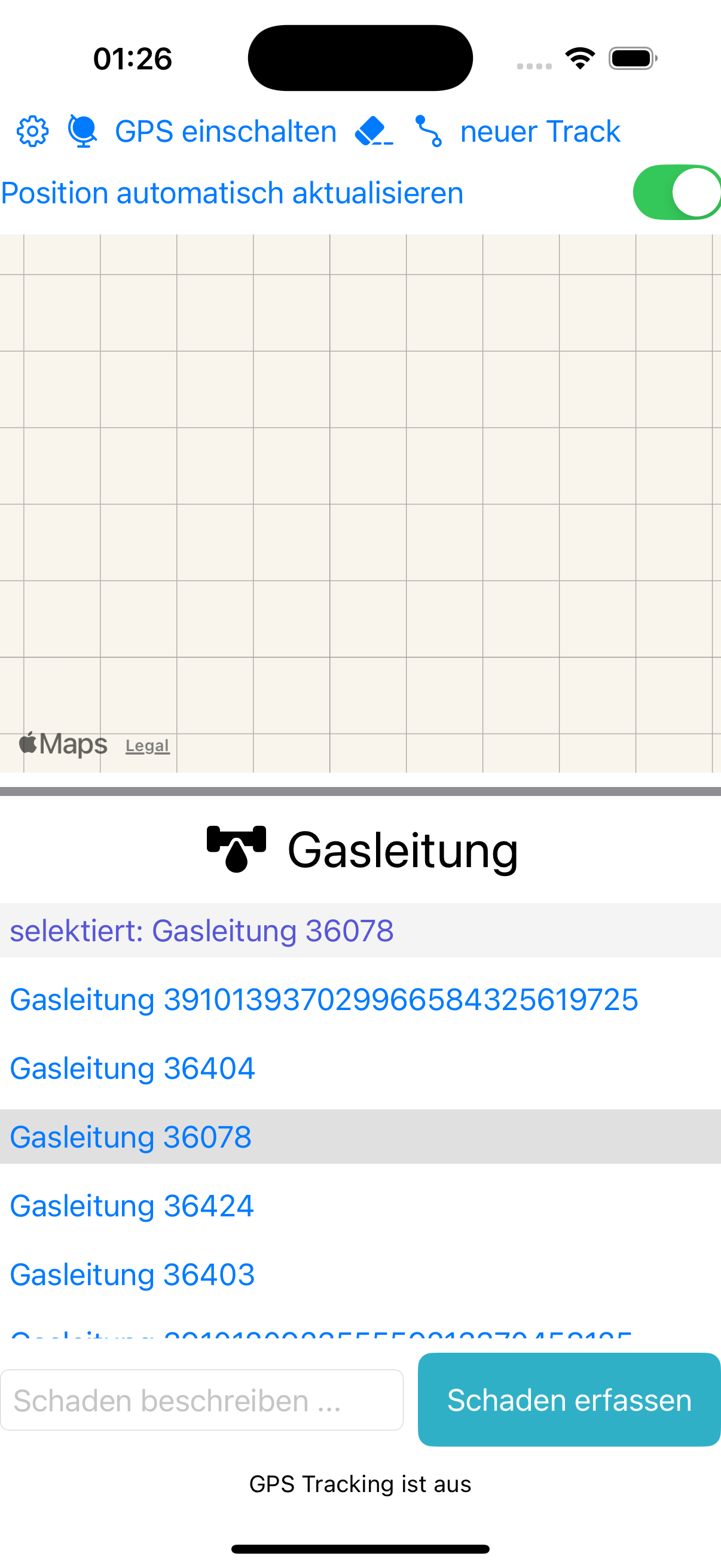
Map View: Central map for visualization
Info Box: Status messages at the bottom of the screen
Toolbar: Function buttons at the top
Pipeline List: Scrollable list of available gas pipelines
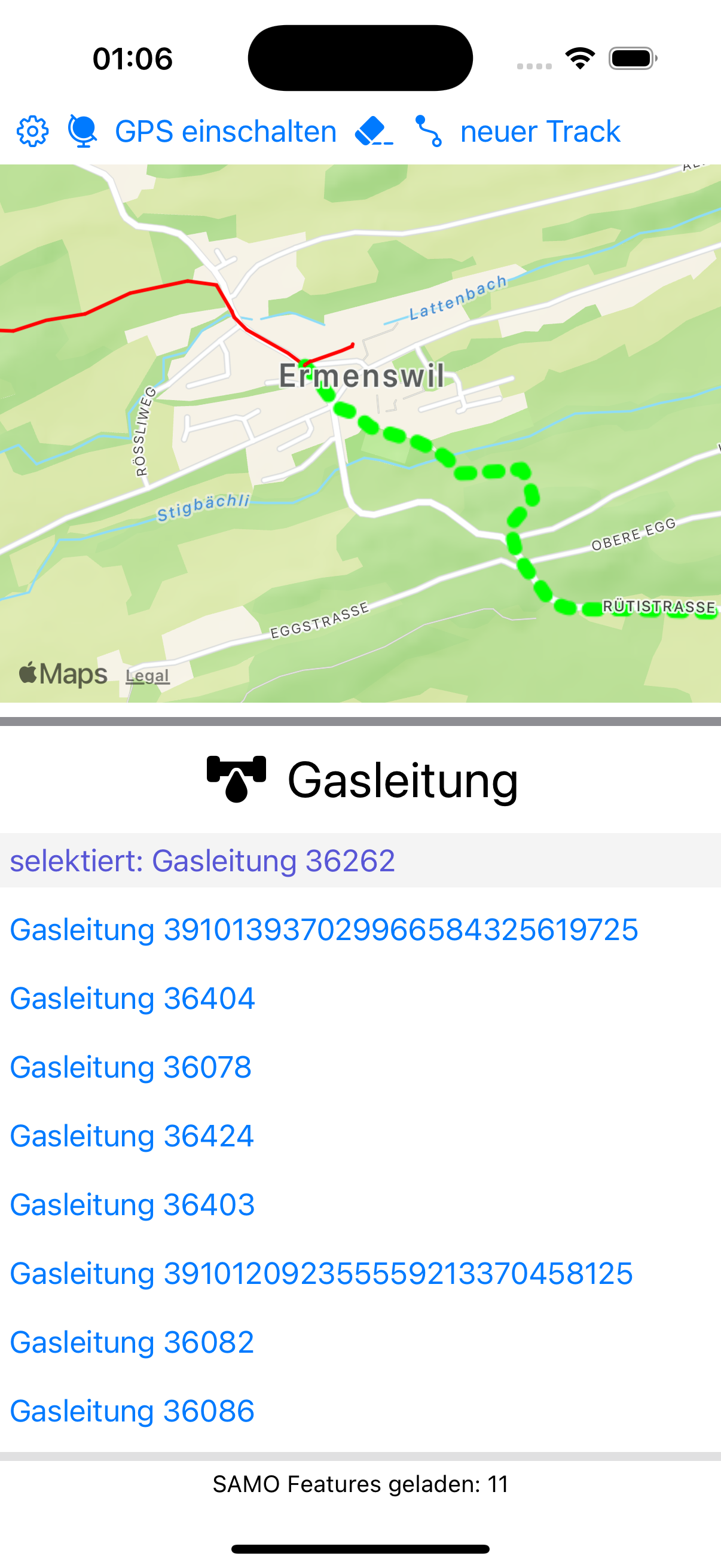
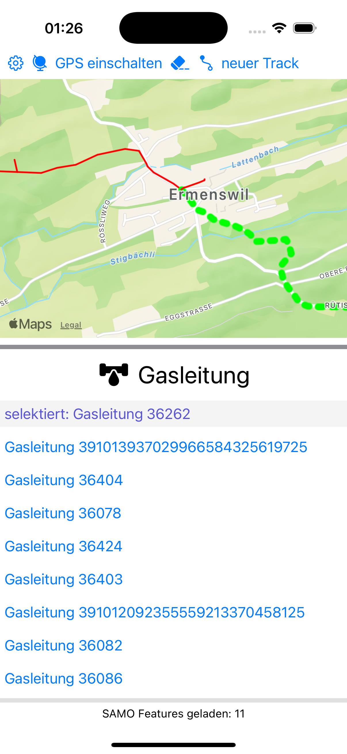
Figure: Main screen with all controls
Navigation
Configuration: Gear symbol (⚙️) for settings
GPS Tracking: Globe symbol for GPS functions
Clear Selection: Eraser symbol to reset selection
New Track: Path symbol for new recordings
Basic operation
Zoom map in/out: use pinch gestures
Move map: drag with one finger
Adjust map height: drag the gray bar under the map
Select gas pipeline: tap an entry in the list
Configuration
Accessing configuration
Tap the gear symbol (⚙️) in the top toolbar
The configuration page opens with different settings areas
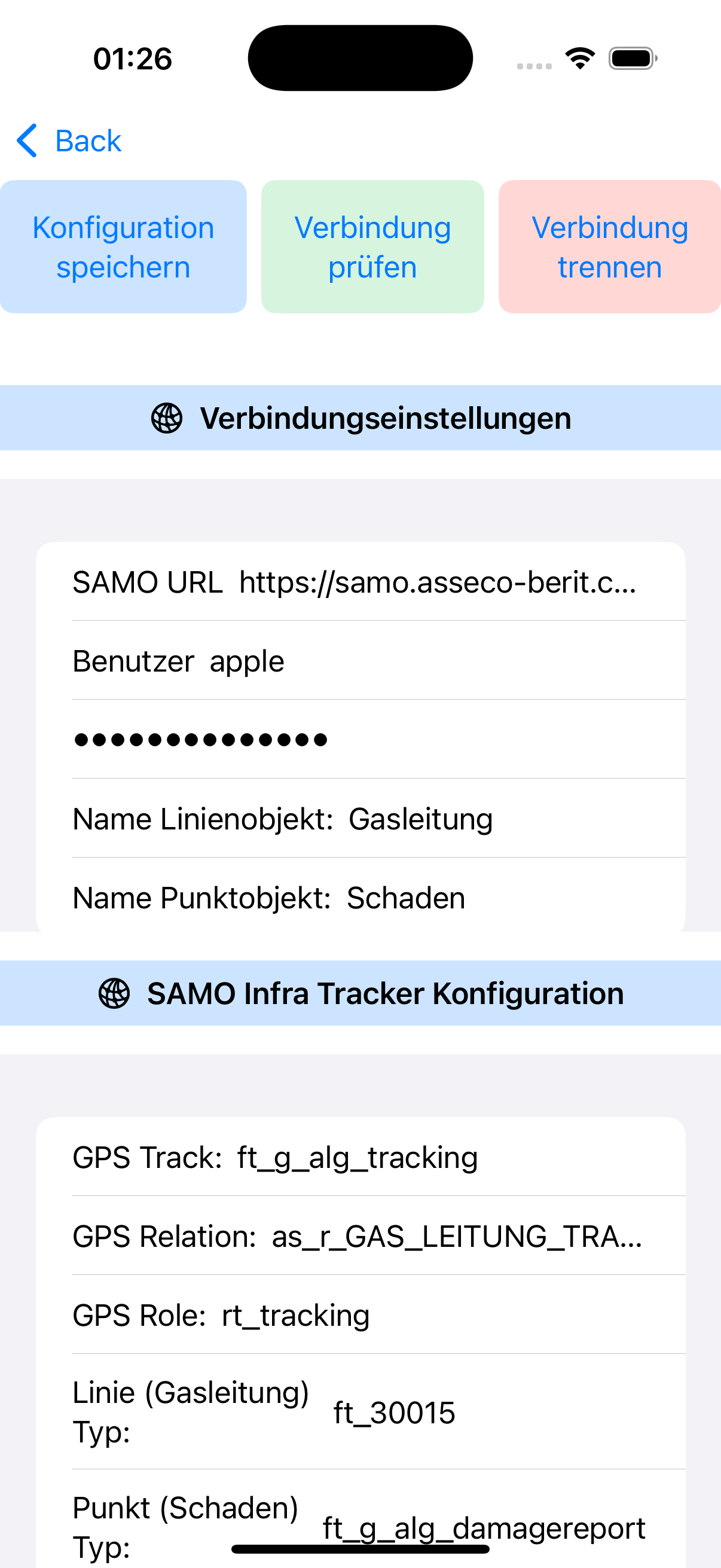
Figure: App configuration page
Connection settings
SAMO URL: Full URL to SAMO backend (e.g. https://samo.asseco-berit.ch/EZL)
User: Your SAMO user name
Password: Your SAMO password (stored securely)
Object type configuration
Line Object Name: Name for line elements (default: "Gasleitung")
Point Object Name: Name for point elements (default: "Schaden")
SAMO Infra Tracker configuration
GPS Track: Feature type for GPS recordings (e.g. ft_g_alg_tracking)
GPS Relation: Relation type for GPS linking (e.g. as_r_GAS_LEITUNG_TRACKING)
GPS Role: Role in relation (e.g. rt_tracking)
Line (Gas pipeline) Type: Feature type for gas pipelines (e.g. ft_30015)
Point (Damage) Type: Feature type for damage reports (e.g. ft_g_alg_damagereport)
Point Relation: Relation type for damage reports
Point Role: Role of damage in relation
Save configuration
Tap "Konfiguration speichern" after changes
Settings are automatically stored when switching apps
Restarting the app loads saved configuration
GPS Tracking and Recording
Select gas pipeline: Choose a gas pipeline from the list
Start GPS tracking: Tap "GPS einschalten"
Automatic position follow: Enable "Position automatisch aktualisieren" toggle
Track without pipeline: If no gas pipeline is selected, a new track can still be started
Continuous recording: GPS points are collected automatically
Background recording: Works even with locked screen
High accuracy: Uses best available GPS precision
Battery usage: Optimized for longer recordings
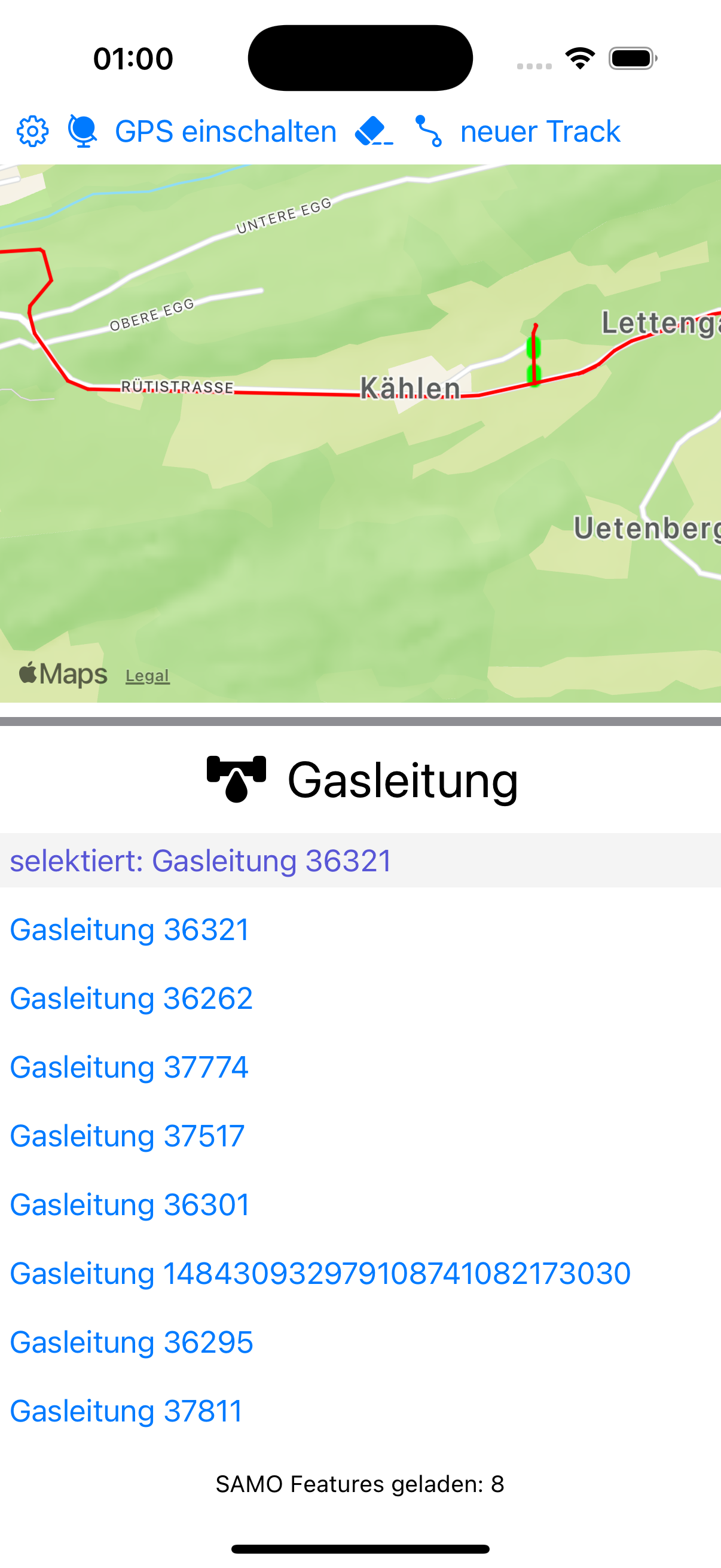
Current track: Displayed live on map as polyline
Track status: Button switches between "GPS einschalten" and "GPS ausschalten"
Track info: Length and coordinates are calculated
Temporary storage: Track data is saved locally
Figure: GPS tracking with active pipeline
New Features (May 2026)
Overview of recent enhancements
Track without relation: GPS track can be created and uploaded without selected pipeline
Option "Position automatisch aktualisieren": Map can follow current GPS position
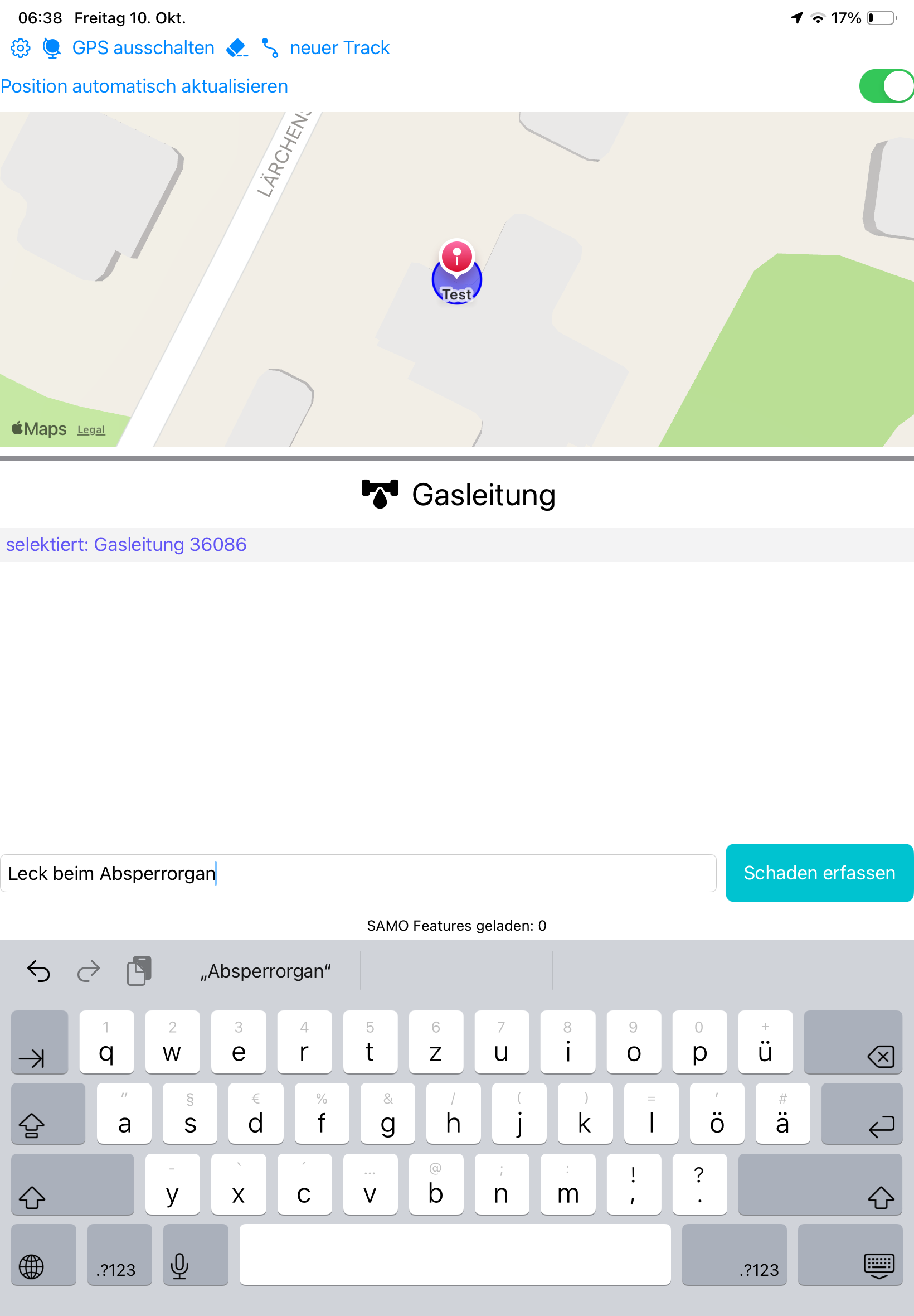
Damage capture on active track: Damage can be linked to the running track
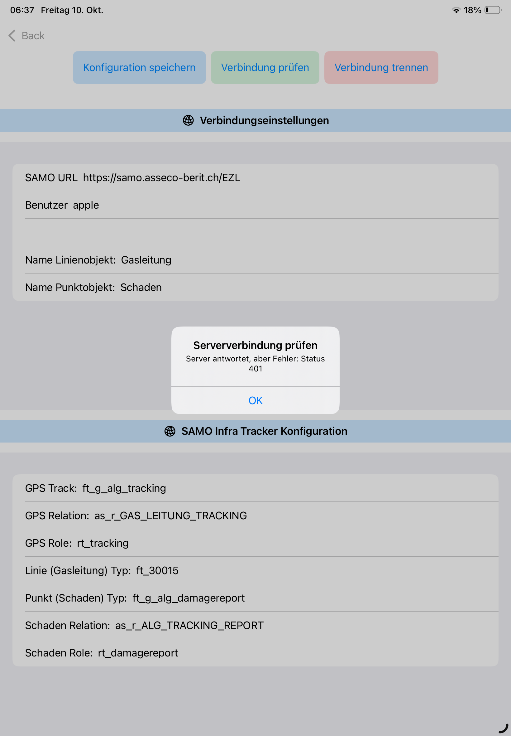
Connection check in configuration: HTTP status shown directly as message (e.g. 401)
More stable map/feature rendering: Status and error messages are clearer in UI
Figure: New tracking view with active track and automatic position updateFigure: Damage capture with input field and action "Schaden erfassen"Figure: Connection check shows server response (example: status 401)
Linking and Managing GPS Tracks
Automatic linking: Tracks are automatically linked to selected gas pipeline
Upload to SAMO: Tracks are transferred to SAMO backend
Reset track: Tap "neuer Track"
Track history: Previously recorded tracks remain available
Monitor track status: Info box messages and visual confirmation
Troubleshooting linking: Hints shown when problems occur
Note: For a track without selected pipeline, data is stored without pipeline relation. The track can still be used later as context for damage capture.
Damage Reports
Capture damage: Prerequisites, localization, description, save
"Server antwortet, aber Fehler: Status 401": Server is reachable, but credentials or permissions are invalid. Check user, password and backend roles.
"Fehler beim Laden der Features: typeMismatch... Expected to decode Double but found an array": Backend response contains geometry coordinates in unexpected format. Check feature type and geometry schema in SAMO.
"Bitte zuerst einen GPS Track starten": A track must be started before creating a damage report.